
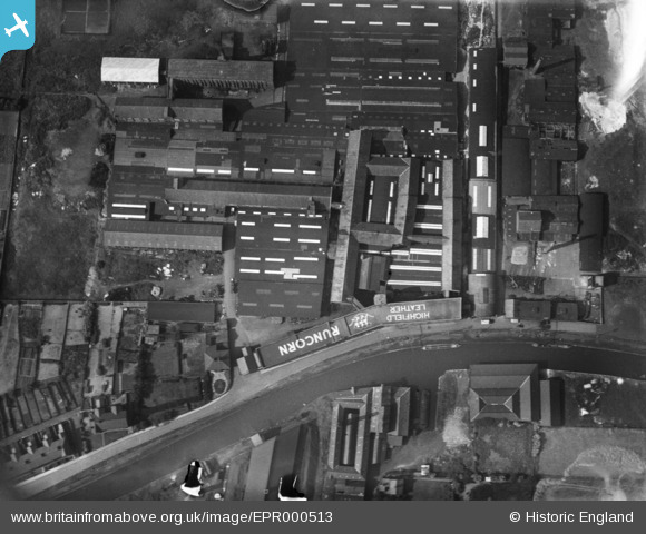
EPR000513 ENGLAND (1934). Highfield Tannery, Runcorn, 1934. This image has been produced from a damaged negative.
© Copyright OpenStreetMap contributors and licensed by the OpenStreetMap Foundation. 2026. Cartography is licensed as CC BY-SA.
Nearby Images (7)
EPR000513

EPR000512A

EPR000598

EPR000594

EPR000595

EPR000596

EPR000597

Details
| Title | [EPR000513] Highfield Tannery, Runcorn, 1934. This image has been produced from a damaged negative. |
| Reference | EPR000513 |
| Date | 9-July-1934 |
| Link | |
| Place name | RUNCORN |
| Parish | |
| District | |
| Country | ENGLAND |
| Easting / Northing | 352640, 383017 |
| Longitude / Latitude | -2.7114049595979, 53.341661495466 |
| National Grid Reference | SJ526830 |
Pins

Bottom Yard |
Wednesday 26th of December 2018 04:29:09 PM | |
|
Bottom Yard |
Wednesday 26th of December 2018 04:28:14 PM | |
|
Bottom Yard |
Wednesday 26th of December 2018 04:22:16 PM | |
|
Bottom Yard |
Wednesday 26th of December 2018 04:18:12 PM |