
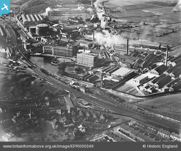
EPR000349 ENGLAND (1934). Burroughs Wellcome Chemical Works and adjacent mills, Dartford, 1934
© Copyright OpenStreetMap contributors and licensed by the OpenStreetMap Foundation. 2026. Cartography is licensed as CC BY-SA.
Nearby Images (20)
EPR000349

EPR000366

EAW001403

EPW010897

EPW006256

EPW010898

EAW001396

EAW001394

EAW001402

EPW028227

EAW001395

EAW001399

EPW010899

EAW001397

EAW001401

EAW001400

EPW057057

EPW010893

EAW001398

EPW010896

Details
| Title | [EPR000349] Burroughs Wellcome Chemical Works and adjacent mills, Dartford, 1934 |
| Reference | EPR000349 |
| Date | 19-September-1934 |
| Link | |
| Place name | DARTFORD |
| Parish | |
| District | |
| Country | ENGLAND |
| Easting / Northing | 554453, 174448 |
| Longitude / Latitude | 0.22292068688344, 51.447437132151 |
| National Grid Reference | TQ545744 |
Pins
Be the first to add a comment to this image!