
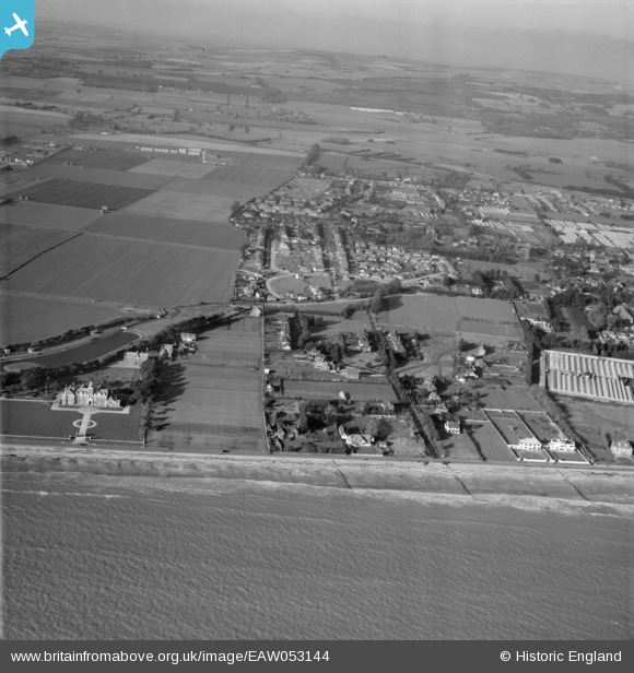
EAW053144 ENGLAND (1954). Harsfold Road and the Poets Corner area, Rustington, from the south, 1954
© Copyright OpenStreetMap contributors and licensed by the OpenStreetMap Foundation. 2026. Cartography is licensed as CC BY-SA.
Nearby Images (7)
EAW053144

EAW053145

EAW053143

EAW053141

EPW017752

EPW017749

EAW053148

Details
| Title | [EAW053144] Harsfold Road and the Poets Corner area, Rustington, from the south, 1954 |
| Reference | EAW053144 |
| Date | 20-February-1954 |
| Link | |
| Place name | RUSTINGTON |
| Parish | RUSTINGTON |
| District | |
| Country | ENGLAND |
| Easting / Northing | 504512, 101447 |
| Longitude / Latitude | -0.51668974009962, 50.8025801838 |
| National Grid Reference | TQ045014 |
Pins

Chad Pixman |
Sunday 9th of August 2020 09:59:26 PM | |
|
Chad Pixman |
Sunday 9th of August 2020 09:55:26 PM | |
|
Chad Pixman |
Sunday 9th of August 2020 09:54:50 PM |