
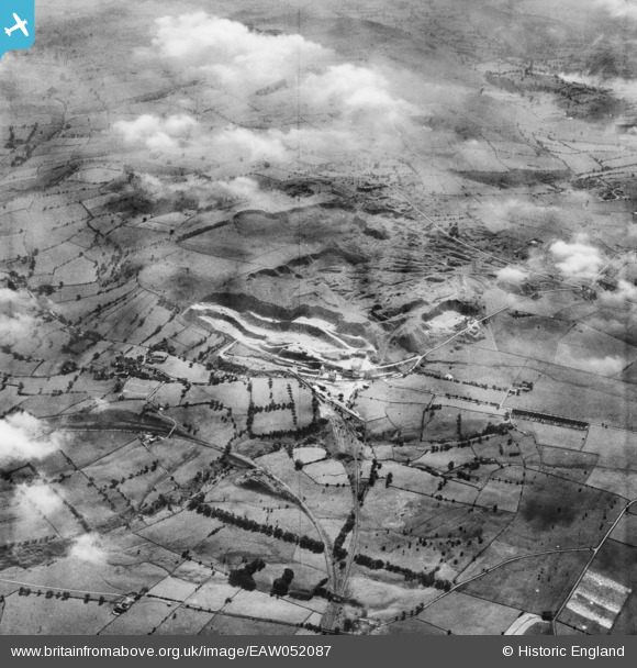
EAW052087 ENGLAND (1953). The Caldonlow Quarries, Cauldon, 1953
© Copyright OpenStreetMap contributors and licensed by the OpenStreetMap Foundation. 2026. Cartography is licensed as CC BY-SA.
Nearby Images (13)
EAW052087

EAW052089

EAW052086

EAW052084

EAW052097

EAW052099

EAW052098

EAW052096

EAW052093

EAW052094

EAW052100

EAW052083

EAW052101

Details
| Title | [EAW052087] The Caldonlow Quarries, Cauldon, 1953 |
| Reference | EAW052087 |
| Date | 7-September-1953 |
| Link | |
| Place name | CAULDON |
| Parish | WATERHOUSES |
| District | |
| Country | ENGLAND |
| Easting / Northing | 407690, 348917 |
| Longitude / Latitude | -1.8853030601822, 53.037170026809 |
| National Grid Reference | SK077489 |
Pins
Be the first to add a comment to this image!