
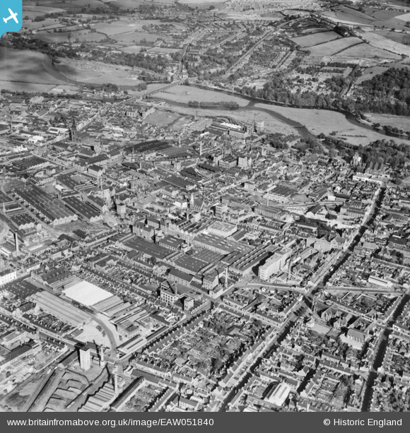
EAW051840 ENGLAND (1953). New Brewery, New Street and environs, Burton upon Trent, 1953
© Copyright OpenStreetMap contributors and licensed by the OpenStreetMap Foundation. 2026. Cartography is licensed as CC BY-SA.
Nearby Images (7)
EAW051840

EAW044102

EAW044099

EPW005819

EPW019724

EAW051839

EAW044096

Details
| Title | [EAW051840] New Brewery, New Street and environs, Burton upon Trent, 1953 |
| Reference | EAW051840 |
| Date | 1-September-1953 |
| Link | |
| Place name | BURTON UPON TRENT |
| Parish | BURTON |
| District | |
| Country | ENGLAND |
| Easting / Northing | 424755, 322985 |
| Longitude / Latitude | -1.6327588194261, 52.803519716372 |
| National Grid Reference | SK248230 |
Pins

Gudello |
Friday 30th of January 2026 10:24:39 AM | |
|
Mark P |
Tuesday 21st of July 2020 10:49:18 PM | |
|
1873ShobnallMaltings |
Saturday 26th of March 2016 12:03:22 PM |