
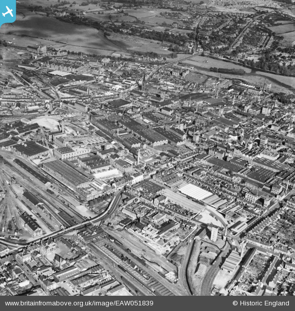
EAW051839 ENGLAND (1953). Borough Road, New Brewery, Middle Brewery and environs, Burton upon Trent, 1953
© Copyright OpenStreetMap contributors and licensed by the OpenStreetMap Foundation. 2026. Cartography is licensed as CC BY-SA.
Nearby Images (4)
EAW051839

EPW019724

EPW005826

EAW051840

Details
| Title | [EAW051839] Borough Road, New Brewery, Middle Brewery and environs, Burton upon Trent, 1953 |
| Reference | EAW051839 |
| Date | 1-September-1953 |
| Link | |
| Place name | BURTON UPON TRENT |
| Parish | BURTON |
| District | |
| Country | ENGLAND |
| Easting / Northing | 424627, 323232 |
| Longitude / Latitude | -1.6346390484096, 52.805746188396 |
| National Grid Reference | SK246232 |
Pins

MB |
Monday 18th of January 2021 01:15:48 PM | |
|
BGP |
Wednesday 12th of November 2014 12:11:27 PM | |
|
BGP |
Wednesday 12th of November 2014 12:07:09 PM | |
|
BGP |
Wednesday 12th of November 2014 12:05:44 PM | |
|
BGP |
Wednesday 12th of November 2014 12:04:30 PM | |
|
BGP |
Wednesday 12th of November 2014 12:02:51 PM | |
|
BGP |
Wednesday 12th of November 2014 12:01:39 PM | |
|
BGP |
Wednesday 12th of November 2014 12:01:03 PM | |
|
BGP |
Wednesday 12th of November 2014 12:00:14 PM | |
|
BGP |
Wednesday 12th of November 2014 11:59:06 AM |