
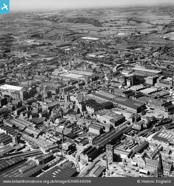
EAW044096 ENGLAND (1952). Breweries, Burton upon Trent, from the east, 1952
© Copyright OpenStreetMap contributors and licensed by the OpenStreetMap Foundation. 2026. Cartography is licensed as CC BY-SA.
Nearby Images (7)
EAW044096

EAW051835

EPW005825

EPW005823

EAW051840

EPW020889

EPW005828

Details
| Title | [EAW044096] Breweries, Burton upon Trent, from the east, 1952 |
| Reference | EAW044096 |
| Date | 10-June-1952 |
| Link | |
| Place name | BURTON UPON TRENT |
| Parish | BURTON |
| District | |
| Country | ENGLAND |
| Easting / Northing | 424944, 323210 |
| Longitude / Latitude | -1.6299378891323, 52.80553383119 |
| National Grid Reference | SK249232 |
Pins

1873ShobnallMaltings |
Saturday 26th of March 2016 11:51:37 AM | |
|
1873ShobnallMaltings |
Saturday 26th of March 2016 11:49:22 AM | |
|
BGP |
Wednesday 12th of November 2014 11:55:32 AM | |
|
BGP |
Wednesday 12th of November 2014 11:54:39 AM |