
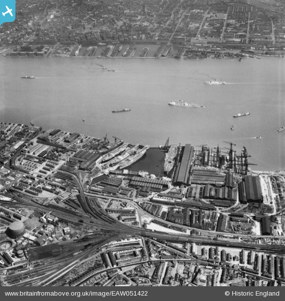
EAW051422 ENGLAND (1953). Cammell Laird's Shipbuilding and Engineering Works and environs, Birkenhead, 1953
© Copyright OpenStreetMap contributors and licensed by the OpenStreetMap Foundation. 2026. Cartography is licensed as CC BY-SA.
Nearby Images (13)
EAW051422

EAW030641

EAW029264

EAW029270

EAW030640

EAW030649

EAW029266

EAW001718

EAW030647

EAW028439

EAW030638

EAW029265

EAW051427

Details
| Title | [EAW051422] Cammell Laird's Shipbuilding and Engineering Works and environs, Birkenhead, 1953 |
| Reference | EAW051422 |
| Date | 12-August-1953 |
| Link | |
| Place name | BIRKENHEAD |
| Parish | |
| District | |
| Country | ENGLAND |
| Easting / Northing | 333105, 388253 |
| Longitude / Latitude | -3.0059101470468, 53.386614338705 |
| National Grid Reference | SJ331883 |
Pins

Vulcanicity |
Monday 8th of July 2024 01:41:44 PM | |
|
beast66606 |
Sunday 23rd of November 2014 10:49:20 AM | |
|
beast66606 |
Sunday 23rd of November 2014 10:48:53 AM |