
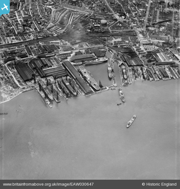
EAW030647 ENGLAND (1950). The Cammell Laird Shipbuilding and Engineering Works, Birkenhead, 1950
© Copyright OpenStreetMap contributors and licensed by the OpenStreetMap Foundation. 2026. Cartography is licensed as CC BY-SA.
Nearby Images (13)
EAW030647

EAW029266

EAW030649

EAW029270

EAW029264

EAW030648

EAW029263

EAW051422

EAW029269

EAW030641

EAW029267

EAW029268

EPW004021

Details
| Title | [EAW030647] The Cammell Laird Shipbuilding and Engineering Works, Birkenhead, 1950 |
| Reference | EAW030647 |
| Date | 29-June-1950 |
| Link | |
| Place name | BIRKENHEAD |
| Parish | |
| District | |
| Country | ENGLAND |
| Easting / Northing | 333145, 388056 |
| Longitude / Latitude | -3.0052670470245, 53.384848719185 |
| National Grid Reference | SJ331881 |
Pins
Be the first to add a comment to this image!