
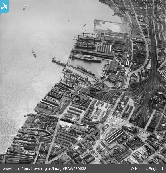
EAW030638 ENGLAND (1950). The Cammell Laird Shipbuilding and Engineering Works, Birkenhead, 1950
© Copyright OpenStreetMap contributors and licensed by the OpenStreetMap Foundation. 2026. Cartography is licensed as CC BY-SA.
Nearby Images (11)
EAW030638

EAW001718

EAW051427

EAW028439

EAW030640

EAW030639

EAW030641

EAW029265

EAW051422

EAW029264

EAW029270

Details
| Title | [EAW030638] The Cammell Laird Shipbuilding and Engineering Works, Birkenhead, 1950 |
| Reference | EAW030638 |
| Date | 29-June-1950 |
| Link | |
| Place name | BIRKENHEAD |
| Parish | |
| District | |
| Country | ENGLAND |
| Easting / Northing | 332900, 388370 |
| Longitude / Latitude | -3.009017107453, 53.387639953857 |
| National Grid Reference | SJ329884 |
Pins
Be the first to add a comment to this image!