
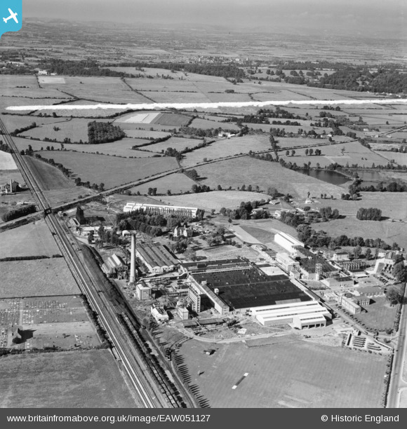
EAW051127 ENGLAND (1953). The British Cellophane Ltd Factory and surrounding area, Bridgwater, from the south-west, 1953. This image was marked by Aerofilms Ltd for photo editing.
© Copyright OpenStreetMap contributors and licensed by the OpenStreetMap Foundation. 2026. Cartography is licensed as CC BY-SA.
Nearby Images (17)
EAW051127

EAW051128

EAW005148

EAW051134

EAW005153

EAW005142

EAW005145

EAW005143

EAW005150

EAW005155

EAW051130

EAW005154

EAW051129

EAW005147

EAW005146

EAW005149

EAW005152

Details
| Title | [EAW051127] The British Cellophane Ltd Factory and surrounding area, Bridgwater, from the south-west, 1953. This image was marked by Aerofilms Ltd for photo editing. |
| Reference | EAW051127 |
| Date | 6-August-1953 |
| Link | |
| Place name | BRIDGWATER |
| Parish | BRIDGWATER |
| District | |
| Country | ENGLAND |
| Easting / Northing | 331003, 138114 |
| Longitude / Latitude | -2.9863140631181, 51.137609128724 |
| National Grid Reference | ST310381 |
Pins
Be the first to add a comment to this image!