
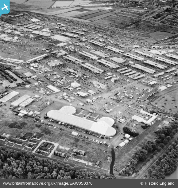
EAW050376 ENGLAND (1953). Blackpool, The Royal Agricultural Society of England Show, 1953
© Copyright OpenStreetMap contributors and licensed by the OpenStreetMap Foundation. 2026. Cartography is licensed as CC BY-SA.
Nearby Images (15)
EAW050376

EAW050392

EAW050393

EPW038731
, Blackpool, 1932. This image has been produced from a print.")
EAW050373

EAW050384

EAW050379

EAW050377

EPW038732
, Blackpool, 1932. This image has been produced from a print.")
EAW050385

EAW050390

EAW050388

EAW050375

EAW050391

EPW038733
, Blackpool, 1932. This image has been produced from a print.")
Details
| Title | [EAW050376] Blackpool, The Royal Agricultural Society of England Show, 1953 |
| Reference | EAW050376 |
| Date | 7-July-1953 |
| Link | |
| Place name | BLACKPOOL |
| Parish | |
| District | |
| Country | ENGLAND |
| Easting / Northing | 333355, 435920 |
| Longitude / Latitude | -3.0123445095954, 53.81507311318 |
| National Grid Reference | SD334359 |
Pins

Matt Aldred edob.mattaldred.com |
Saturday 15th of May 2021 05:58:21 PM | |
|
Matt Aldred edob.mattaldred.com |
Tuesday 30th of March 2021 05:23:58 PM |