
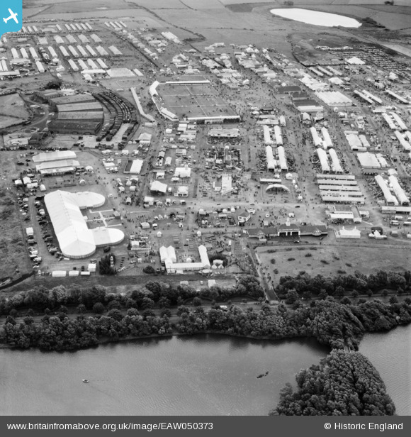
EAW050373 ENGLAND (1953). Blackpool, The Royal Agricultural Society of England Show, 1953
© Copyright OpenStreetMap contributors and licensed by the OpenStreetMap Foundation. 2026. Cartography is licensed as CC BY-SA.
Nearby Images (13)
EAW050373

EAW050392

EAW050376

EPW038731
, Blackpool, 1932. This image has been produced from a print.")
EAW050384

EAW050393

EAW050375

EAW050379

EAW050377

EAW050385

EAW050390

EPW038732
, Blackpool, 1932. This image has been produced from a print.")
EAW050388

Details
| Title | [EAW050373] Blackpool, The Royal Agricultural Society of England Show, 1953 |
| Reference | EAW050373 |
| Date | 7-July-1953 |
| Link | |
| Place name | BLACKPOOL |
| Parish | |
| District | |
| Country | ENGLAND |
| Easting / Northing | 333255, 435925 |
| Longitude / Latitude | -3.0138643429456, 53.815105223184 |
| National Grid Reference | SD333359 |
Pins

Matt Aldred edob.mattaldred.com |
Saturday 15th of May 2021 04:18:47 PM | |
|
Matt Aldred edob.mattaldred.com |
Saturday 15th of May 2021 04:18:27 PM | |
|
Matt Aldred edob.mattaldred.com |
Saturday 15th of May 2021 04:18:12 PM | |
|
Matt Aldred edob.mattaldred.com |
Saturday 15th of May 2021 04:17:18 PM |