
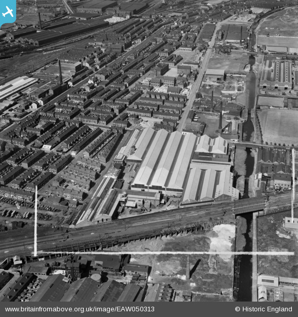
EAW050313 ENGLAND (1953). The R & J Dempster Ltd Gas Plant Works and environs, Newton Heath, 1953. This image was marked by Aerofilms Ltd for photo editing.
© Copyright OpenStreetMap contributors and licensed by the OpenStreetMap Foundation. 2026. Cartography is licensed as CC BY-SA.
Nearby Images (18)
EAW050313

EPW050196

EPW050195

EPW050191

EPW050192

EPW050197

EPW050199

EAW050311

EAW050312

EPW050198

EPW050193

EPW050194

EAW050316

EAW050314

EAW050317

EAW050315

EAW050310

EAW045582

Details
| Title | [EAW050313] The R & J Dempster Ltd Gas Plant Works and environs, Newton Heath, 1953. This image was marked by Aerofilms Ltd for photo editing. |
| Reference | EAW050313 |
| Date | 3-July-1953 |
| Link | |
| Place name | NEWTON HEATH |
| Parish | |
| District | |
| Country | ENGLAND |
| Easting / Northing | 386661, 399980 |
| Longitude / Latitude | -2.2010940149918, 53.496103038432 |
| National Grid Reference | SJ8671000 |
Pins

J Ashton |
Saturday 7th of April 2018 02:17:11 PM | |
|
J Ashton |
Saturday 7th of April 2018 02:16:33 PM | |
|
J Ashton |
Saturday 7th of April 2018 02:16:06 PM | |
|
J Ashton |
Saturday 7th of April 2018 02:14:40 PM | |
|
John T. Pitman |
Monday 21st of December 2015 11:04:57 PM |