
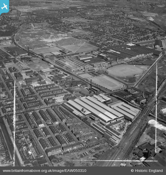
EAW050310 ENGLAND (1953). The R & J Dempster Ltd Gas Plant Works and environs, Newton Heath, 1953. This image was marked by Aerofilms Ltd for photo editing.
© Copyright OpenStreetMap contributors and licensed by the OpenStreetMap Foundation. 2026. Cartography is licensed as CC BY-SA.
Nearby Images (17)
EAW050310

EAW050315

EAW050314

EPW050198

EAW050312

EAW050311

EPW050199

EPW050195

EAW050316

EPW050197

EPW050191

EPW050192

EAW050317

EAW050313

EPW050194

EPW050196

EPW050193

Details
| Title | [EAW050310] The R & J Dempster Ltd Gas Plant Works and environs, Newton Heath, 1953. This image was marked by Aerofilms Ltd for photo editing. |
| Reference | EAW050310 |
| Date | 3-July-1953 |
| Link | |
| Place name | NEWTON HEATH |
| Parish | |
| District | |
| Country | ENGLAND |
| Easting / Northing | 386859, 399990 |
| Longitude / Latitude | -2.1981094762242, 53.496197916779 |
| National Grid Reference | SJ8691000 |
Pins

Shane |
Sunday 23rd of November 2014 05:59:08 PM | |
|
TheBlueCube |
Sunday 6th of July 2014 08:48:23 PM |