
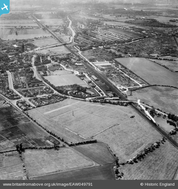
EAW049791 ENGLAND (1953). The Cementation Co Works and the surrounding area, Bentley, 1953
© Copyright OpenStreetMap contributors and licensed by the OpenStreetMap Foundation. 2026. Cartography is licensed as CC BY-SA.
Nearby Images (36)
EAW049791

EPW041515

EAW048673

EPW041509

EPW041508

EPW041511

EPW041512

EPW041513

EAW048674

EAW049794

EAW048677

EPW042044

EPW041514

EAW049173

EPW042041

EAW049792

EAW049793

EPW041510

EAW049172

EAW048675

EAW046011

EAW046010

EAW049174

EAW046018

EAW046012

EAW048678

EAW046016

EPW042042

EAW049795

EAW048676

EPW042043

EAW049796

EPW042045

EAW046015

EAW046017

EAW046013

Details
| Title | [EAW049791] The Cementation Co Works and the surrounding area, Bentley, 1953 |
| Reference | EAW049791 |
| Date | 30-May-1953 |
| Link | |
| Place name | BENTLEY |
| Parish | |
| District | |
| Country | ENGLAND |
| Easting / Northing | 456225, 405943 |
| Longitude / Latitude | -1.151349452099, 53.546865274625 |
| National Grid Reference | SE562059 |
Pins
Be the first to add a comment to this image!