
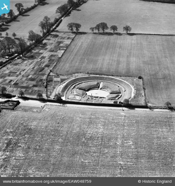
EAW048759 ENGLAND (1953). The site of Verulamium Roman Town and Theatre, St Albans, 1953
© Copyright OpenStreetMap contributors and licensed by the OpenStreetMap Foundation. 2026. Cartography is licensed as CC BY-SA.
Nearby Images (19)
EAW048759

EAW011297

EAW048758

EAW011295

EAW011298

EAW011296

EAW048028

EAW048029

EAW053205

EAW053206

EAW015574

EAW015575

EAW053204

EAW053207

EAW053208

EAW016025

EAW016027

EAW015576

EAW015577

Details
| Title | [EAW048759] The site of Verulamium Roman Town and Theatre, St Albans, 1953 |
| Reference | EAW048759 |
| Date | 22-April-1953 |
| Link | |
| Place name | ST ALBANS |
| Parish | ST. MICHAEL |
| District | |
| Country | ENGLAND |
| Easting / Northing | 513423, 207416 |
| Longitude / Latitude | -0.35662103940733, 51.753483021 |
| National Grid Reference | TL134074 |
Pins
Be the first to add a comment to this image!