
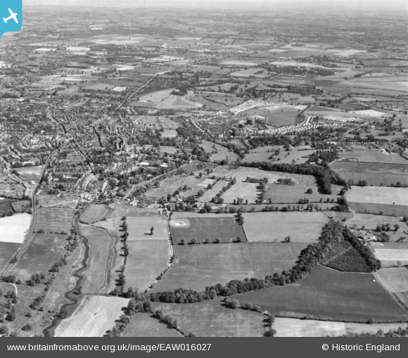
EAW016027 ENGLAND (1948). The site of Roman Verulamium and the modern city, St Albans, from the north-west, 1948. This image has been produced from a print.
© Copyright OpenStreetMap contributors and licensed by the OpenStreetMap Foundation. 2026. Cartography is licensed as CC BY-SA.
Nearby Images (16)
EAW016027

EAW053208

EAW015574

EAW015575

EAW053205

EAW011298

EAW011295

EAW048758

EAW011297

EAW048028

EAW053206

EAW048759

EAW011296

EAW048029

EAW016025

EAW053204

Details
| Title | [EAW016027] The site of Roman Verulamium and the modern city, St Albans, from the north-west, 1948. This image has been produced from a print. |
| Reference | EAW016027 |
| Date | 19-May-1948 |
| Link | |
| Place name | ST ALBANS |
| Parish | ST. MICHAEL |
| District | |
| Country | ENGLAND |
| Easting / Northing | 513254, 207378 |
| Longitude / Latitude | -0.35908096793739, 51.753175662406 |
| National Grid Reference | TL133074 |
Pins
Be the first to add a comment to this image!