
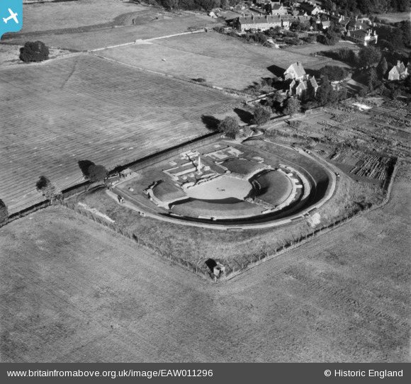
EAW011296 ENGLAND (1947). Roman theatre at Verulamium, St Albans, 1947
© Copyright OpenStreetMap contributors and licensed by the OpenStreetMap Foundation. 2026. Cartography is licensed as CC BY-SA.
Nearby Images (19)
EAW011296

EAW011297

EAW011295

EAW011298

EAW048759

EAW053205

EAW048758

EAW048029

EAW048028

EAW015574

EAW015575

EAW053206

EAW053204

EAW053207

EAW053208

EAW016025

EAW016027

EAW015576

EAW015577

Details
| Title | [EAW011296] Roman theatre at Verulamium, St Albans, 1947 |
| Reference | EAW011296 |
| Date | 30-September-1947 |
| Link | |
| Place name | ST ALBANS |
| Parish | ST. MICHAEL |
| District | |
| Country | ENGLAND |
| Easting / Northing | 513423, 207434 |
| Longitude / Latitude | -0.3566151656126, 51.753644812482 |
| National Grid Reference | TL134074 |
Pins
Be the first to add a comment to this image!