
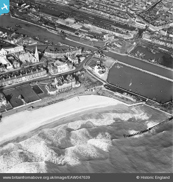
EAW047639 ENGLAND (1952). The Royal Hotel on South Beach, South Basin and environs, Lowestoft, 1952
© Copyright OpenStreetMap contributors and licensed by the OpenStreetMap Foundation. 2026. Cartography is licensed as CC BY-SA.
Nearby Images (11)
EAW047639

EAW025475

EAW031906

EPW021242

EAW052979

EAW052981

EPW021243

EAW005063

EAW031908

EAW031909

EAW052982

Details
| Title | [EAW047639] The Royal Hotel on South Beach, South Basin and environs, Lowestoft, 1952 |
| Reference | EAW047639 |
| Date | 23-October-1952 |
| Link | |
| Place name | LOWESTOFT |
| Parish | |
| District | |
| Country | ENGLAND |
| Easting / Northing | 654802, 292560 |
| Longitude / Latitude | 1.7521283927816, 52.471019482193 |
| National Grid Reference | TM548926 |
Pins

Brightonboy |
Monday 18th of August 2014 08:49:54 PM | |
|
Brightonboy |
Sunday 10th of August 2014 10:45:05 PM | |
|
Brightonboy |
Sunday 10th of August 2014 10:42:24 PM | |
|
Brightonboy |
Sunday 10th of August 2014 10:41:49 PM |