
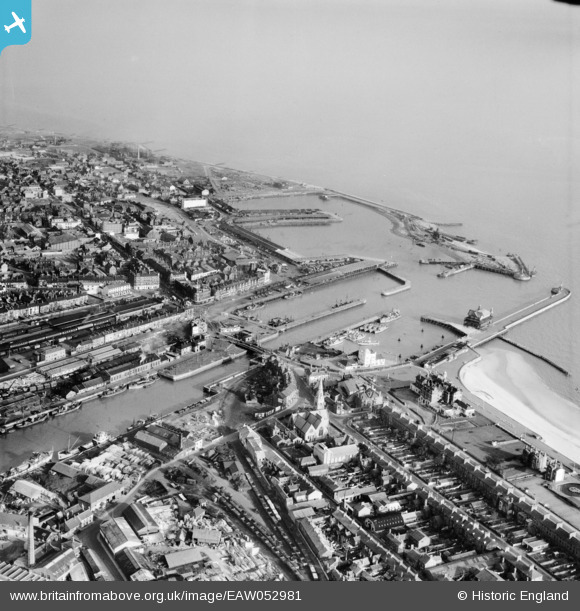
EAW052981 ENGLAND (1953). The docks and harbours, Lowestoft, from the south-west, 1953
© Copyright OpenStreetMap contributors and licensed by the OpenStreetMap Foundation. 2026. Cartography is licensed as CC BY-SA.
Nearby Images (12)
EAW052981

EPW021242

EPW021243

EAW025475

EAW047639

EAW052982

EAW031906

EAW052979

EAW031908

EAW047637

EAW031909

EAW052978

Details
| Title | [EAW052981] The docks and harbours, Lowestoft, from the south-west, 1953 |
| Reference | EAW052981 |
| Date | 19-November-1953 |
| Link | |
| Place name | LOWESTOFT |
| Parish | |
| District | |
| Country | ENGLAND |
| Easting / Northing | 654669, 292608 |
| Longitude / Latitude | 1.7502110951015, 52.471512169028 |
| National Grid Reference | TM547926 |
Pins

Brightonboy |
Friday 29th of January 2021 09:28:37 PM | |
|
Brightonboy |
Friday 29th of January 2021 09:27:43 PM | |
|
Brightonboy |
Friday 29th of January 2021 09:26:42 PM | |
|
Brightonboy |
Friday 29th of January 2021 09:25:05 PM | |
|
Brightonboy |
Friday 29th of January 2021 09:24:26 PM | |
|
Eddy |
Tuesday 18th of August 2020 09:54:19 PM |