
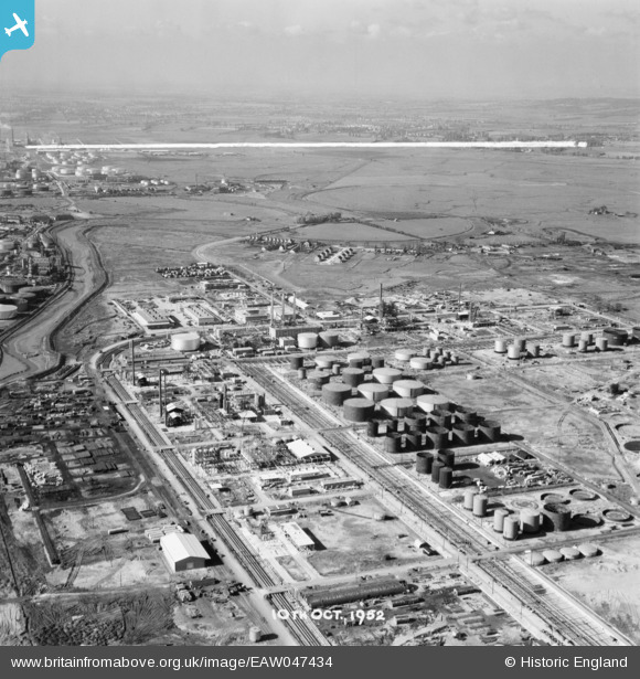
EAW047434 ENGLAND (1952). Coryton Oil Refinery and environs, Coryton, from the south-east, 1952. This image was marked by Aerofilms Ltd for photo editing.
© Copyright OpenStreetMap contributors and licensed by the OpenStreetMap Foundation. 2026. Cartography is licensed as CC BY-SA.
Nearby Images (48)
EAW047434

EAW042281

EAW048596

EAW042283

EAW034433

EAW045737

EAW048101

EAW034408

EAW048584

EAW045736

EAW048099

EAW047433

EAW039889

EAW039890

EAW048096

EAW048098

EAW042278

EAW051376

EAW048585

EAW048586

EAW048088

EAW048599

EAW051375

EAW042279

EAW048593

EAW042267

EAW042282

EAW035774

EAW043890

EAW039891

EAW048106

EAW051374

EAW045735

EAW042268

EAW047435

EAW048090

EAW039895

EAW048087

EAW043889

EAW042269

EAW045732

EAW039893

EAW034434

EAW039881

EAW048302

EAW039892

EAW047426

EAW041996

Details
| Title | [EAW047434] Coryton Oil Refinery and environs, Coryton, from the south-east, 1952. This image was marked by Aerofilms Ltd for photo editing. |
| Reference | EAW047434 |
| Date | 10-October-1952 |
| Link | |
| Place name | CORYTON |
| Parish | |
| District | |
| Country | ENGLAND |
| Easting / Northing | 575284, 182250 |
| Longitude / Latitude | 0.52630261693808, 51.511464273822 |
| National Grid Reference | TQ753823 |
Pins
Be the first to add a comment to this image!