
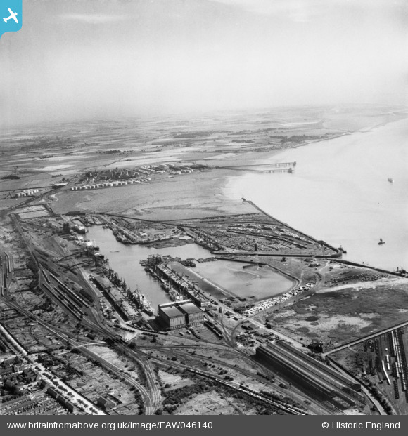
EAW046140 ENGLAND (1952). King George Dock, Kingston upon Hull, from the north-west, 1952
© Copyright OpenStreetMap contributors and licensed by the OpenStreetMap Foundation. 2026. Cartography is licensed as CC BY-SA.
Nearby Images (11)
EAW046140

EPW036558

EPW010819

EPW036389

EPW036418

EPW036530

EAW004510

EAW183440

EAW004509

EPW055043

EPW010824

Details
| Title | [EAW046140] King George Dock, Kingston upon Hull, from the north-west, 1952 |
| Reference | EAW046140 |
| Date | 22-August-1952 |
| Link | |
| Place name | KINGSTON UPON HULL |
| Parish | |
| District | |
| Country | ENGLAND |
| Easting / Northing | 513914, 428960 |
| Longitude / Latitude | -0.27249075288414, 53.744331542585 |
| National Grid Reference | TA139290 |
Pins

John Wass |
Friday 27th of February 2015 07:59:30 PM |