
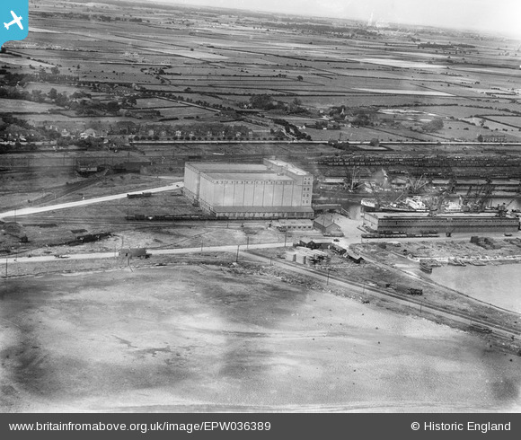
EPW036389 ENGLAND (1931). The Grain Silo at King George Dock and surroundings, Kingston upon Hull, 1931
© Copyright OpenStreetMap contributors and licensed by the OpenStreetMap Foundation. 2026. Cartography is licensed as CC BY-SA.
Nearby Images (11)
EPW036389

EPW036530

EPW010819

EPW036418

EAW046140

EPW036558

EAW004510

EPW055042

EAW015656

EAW004509

EAW183440

Details
| Title | [EPW036389] The Grain Silo at King George Dock and surroundings, Kingston upon Hull, 1931 |
| Reference | EPW036389 |
| Date | August-1931 |
| Link | |
| Place name | KINGSTON UPON HULL |
| Parish | |
| District | |
| Country | ENGLAND |
| Easting / Northing | 513823, 429008 |
| Longitude / Latitude | -0.27385240037613, 53.744782700491 |
| National Grid Reference | TA138290 |
