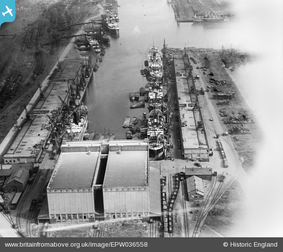
EPW036558 ENGLAND (1931). Grain silo and warehouses at the west end of King George Dock, Kingston upon Hull, 1931
© Copyright OpenStreetMap contributors and licensed by the OpenStreetMap Foundation. 2026. Cartography is licensed as CC BY-SA.
Nearby Images (10)
Details
| Title | [EPW036558] Grain silo and warehouses at the west end of King George Dock, Kingston upon Hull, 1931 |
| Reference | EPW036558 |
| Date | August-1931 |
| Link | |
| Place name | KINGSTON UPON HULL |
| Parish | |
| District | |
| Country | ENGLAND |
| Easting / Northing | 513959, 428971 |
| Longitude / Latitude | -0.27180461151664, 53.744420542265 |
| National Grid Reference | TA140290 |
Pins
Be the first to add a comment to this image!


![[EPW036558] Grain silo and warehouses at the west end of King George Dock, Kingston upon Hull, 1931](http://britainfromabove.org.uk/sites/all/libraries/aerofilms-images/public/100x100/EPW/036/EPW036558.jpg)
![[EAW046140] King George Dock, Kingston upon Hull, from the north-west, 1952](http://britainfromabove.org.uk/sites/all/libraries/aerofilms-images/public/100x100/EAW/046/EAW046140.jpg)
![[EPW010819] King George Dock and the Grain Silo, Kingston upon Hull, 1924](http://britainfromabove.org.uk/sites/all/libraries/aerofilms-images/public/100x100/EPW/010/EPW010819.jpg)
![[EPW036418] Boats outside the King George Dock Grain Silo, Kingston upon Hull, 1931](http://britainfromabove.org.uk/sites/all/libraries/aerofilms-images/public/100x100/EPW/036/EPW036418.jpg)
![[EAW183440] Ferry terminal at King George Dock, Kingston upon Hull, 1968](http://britainfromabove.org.uk/sites/all/libraries/aerofilms-images/public/100x100/EAW/183/EAW183440.jpg)
![[EPW036389] The Grain Silo at King George Dock and surroundings, Kingston upon Hull, 1931](http://britainfromabove.org.uk/sites/all/libraries/aerofilms-images/public/100x100/EPW/036/EPW036389.jpg)
![[EPW036530] Grain Silo at the west end of the King George Dock, Kingston upon Hull, 1931](http://britainfromabove.org.uk/sites/all/libraries/aerofilms-images/public/100x100/EPW/036/EPW036530.jpg)
![[EPW055043] King George Dock, Kingston upon Hull, 1937. This image has been produced from a print.](http://britainfromabove.org.uk/sites/all/libraries/aerofilms-images/public/100x100/EPW/055/EPW055043.jpg)
![[EAW004509] King George Dock, Kingston upon Hull, 1947](http://britainfromabove.org.uk/sites/all/libraries/aerofilms-images/public/100x100/EAW/004/EAW004509.jpg)
![[EAW004510] King George Dock and environs, Kingston upon Hull, from the west, 1947](http://britainfromabove.org.uk/sites/all/libraries/aerofilms-images/public/100x100/EAW/004/EAW004510.jpg)