
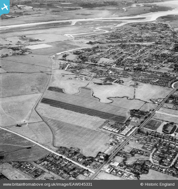
EAW045331 ENGLAND (1952). Long Road and the residential area around The Lake, Canvey Island, 1952
© Copyright OpenStreetMap contributors and licensed by the OpenStreetMap Foundation. 2026. Cartography is licensed as CC BY-SA.
Nearby Images (4)
EAW045331

EAW045314

EAW026929

EAW045312

Details
| Title | [EAW045331] Long Road and the residential area around The Lake, Canvey Island, 1952 |
| Reference | EAW045331 |
| Date | 2-August-1952 |
| Link | |
| Place name | CANVEY ISLAND |
| Parish | CANVEY ISLAND |
| District | |
| Country | ENGLAND |
| Easting / Northing | 578709, 183591 |
| Longitude / Latitude | 0.57629270969895, 51.522438022417 |
| National Grid Reference | TQ787836 |
Pins

tiv |
Sunday 13th of August 2017 04:24:36 PM |