
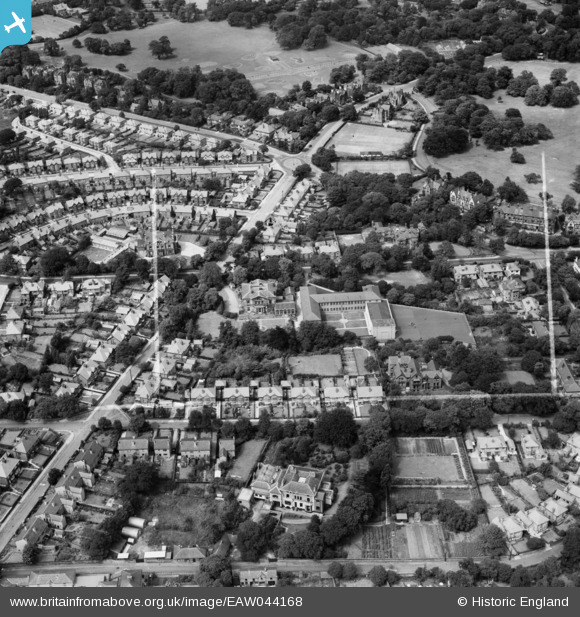
EAW044168 ENGLAND (1952). St Anselm's College and the surrounding residential area, Birkenhead, 1952. This image was marked by Aerofilms Ltd for photo editing.
© Copyright OpenStreetMap contributors and licensed by the OpenStreetMap Foundation. 2026. Cartography is licensed as CC BY-SA.
Nearby Images (5)
EAW044168

EAW044167

EAW044165

EAW044166

EAW044169

Details
| Title | [EAW044168] St Anselm's College and the surrounding residential area, Birkenhead, 1952. This image was marked by Aerofilms Ltd for photo editing. |
| Reference | EAW044168 |
| Date | 19-June-1952 |
| Link | |
| Place name | BIRKENHEAD |
| Parish | |
| District | |
| Country | ENGLAND |
| Easting / Northing | 330355, 388650 |
| Longitude / Latitude | -3.0473424697469, 53.389827106036 |
| National Grid Reference | SJ304887 |
Pins

XMAS DAY |
Tuesday 5th of November 2024 09:09:59 PM | |
|
XMAS DAY |
Tuesday 5th of November 2024 09:06:42 PM | |
|
XMAS DAY |
Tuesday 5th of November 2024 09:05:35 PM | |
|
XMAS DAY |
Tuesday 5th of November 2024 09:04:35 PM | |
|
XMAS DAY |
Tuesday 5th of November 2024 09:03:20 PM |