
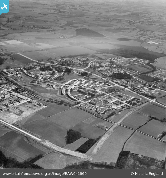
EAW041969 ENGLAND (1952). Development of the Mark Hall neighbourhood, Mark Hall North, 1952
© Copyright OpenStreetMap contributors and licensed by the OpenStreetMap Foundation. 2026. Cartography is licensed as CC BY-SA.
Nearby Images (7)
EAW041969

EAW041965

EAW041964

EAW041968

EAW041966

EAW041963

EAW041967

Details
| Title | [EAW041969] Development of the Mark Hall neighbourhood, Mark Hall North, 1952 |
| Reference | EAW041969 |
| Date | 14-March-1952 |
| Link | |
| Place name | MARK HALL NORTH |
| Parish | |
| District | |
| Country | ENGLAND |
| Easting / Northing | 546224, 211021 |
| Longitude / Latitude | 0.11983688383675, 51.778275002115 |
| National Grid Reference | TL462110 |
Pins
Be the first to add a comment to this image!