
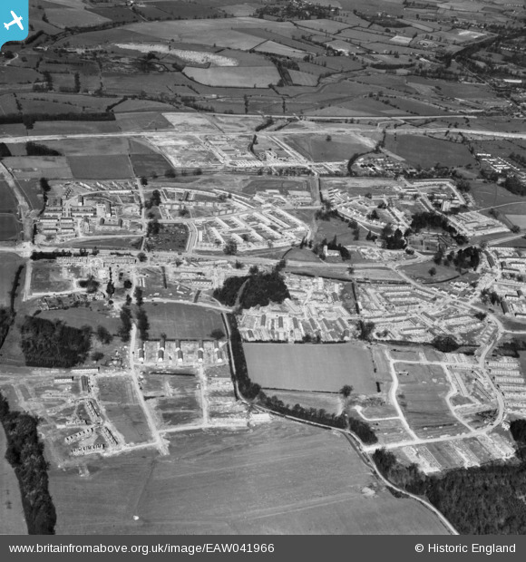
EAW041966 ENGLAND (1952). Development of the Mark Hall neighbourhood, Mark Hall North, 1952
© Copyright OpenStreetMap contributors and licensed by the OpenStreetMap Foundation. 2026. Cartography is licensed as CC BY-SA.
Nearby Images (5)
EAW041966

EAW041964

EAW041965

EAW041969

EAW041963

Details
| Title | [EAW041966] Development of the Mark Hall neighbourhood, Mark Hall North, 1952 |
| Reference | EAW041966 |
| Date | 14-March-1952 |
| Link | |
| Place name | MARK HALL NORTH |
| Parish | |
| District | |
| Country | ENGLAND |
| Easting / Northing | 546244, 210798 |
| Longitude / Latitude | 0.12003266401942, 51.776265915337 |
| National Grid Reference | TL462108 |
Pins

robert |
Thursday 4th of August 2022 07:19:17 PM | |
|
robert |
Thursday 4th of August 2022 07:18:41 PM | |
|
robert |
Thursday 4th of August 2022 07:17:15 PM | |
|
NJL61 |
Saturday 5th of March 2022 02:36:39 PM | |
|
Terry |
Saturday 3rd of January 2015 02:09:15 PM | |
|
Terry |
Saturday 3rd of January 2015 02:04:20 PM |