
Scheduled Maintenance
This website will undergo scheduled maintenance on Tuesday, September 10th, between 11:00 and 15:00, as well as on Thursday, September 12th, between 10:00 and 12:00. During this time, services may be temporarily disrupted. We apologise for any inconvenience.
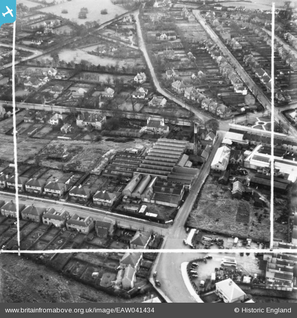
EAW041434 ENGLAND (1951). Croft Mill off Forest Road, Mansfield, 1951. This image has been produced from a print marked by Aerofilms Ltd for photo editing.
© Copyright OpenStreetMap contributors and licensed by the OpenStreetMap Foundation. 2024. Cartography is licensed as CC BY-SA.
Nearby Images (9)
EAW041434

EAW041432

EAW041431

EAW041427

EAW041430

EAW041429

EAW041435

EAW041428

EAW041433

Details
| Title | [EAW041434] Croft Mill off Forest Road, Mansfield, 1951. This image has been produced from a print marked by Aerofilms Ltd for photo editing. |
| Reference | EAW041434 |
| Date | 27-December-1951 |
| Link | |
| Place name | MANSFIELD |
| Parish | |
| District | |
| Country | ENGLAND |
| Easting / Northing | 453916, 359766 |
| Longitude / Latitude | -1.1940615172099, 53.132031425306 |
| National Grid Reference | SK539598 |
Pins
Be the first to add a comment to this image!