
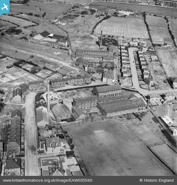
EAW035560 ENGLAND (1951). Longfield Shoddy Mills, Heckmondwike, 1951
© Copyright OpenStreetMap contributors and licensed by the OpenStreetMap Foundation. 2025. Cartography is licensed as CC BY-SA.
Nearby Images (10)
EAW035560

EAW035562

EAW035564

EAW035556

EAW035555

EAW035557

EAW035558

EAW035559

EAW035563

EAW035561

Details
| Title | [EAW035560] Longfield Shoddy Mills, Heckmondwike, 1951 |
| Reference | EAW035560 |
| Date | 21-April-1951 |
| Link | |
| Place name | HECKMONDWIKE |
| Parish | |
| District | |
| Country | ENGLAND |
| Easting / Northing | 422038, 424022 |
| Longitude / Latitude | -1.6660645420992, 53.711927707104 |
| National Grid Reference | SE220240 |
Pins
Be the first to add a comment to this image!