
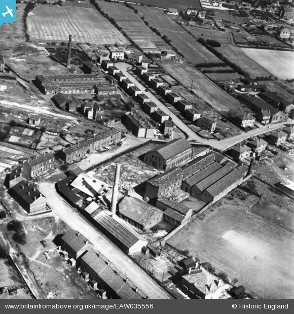
EAW035556 ENGLAND (1951). Longfield Shoddy Mills and Chapel Avenue, Heckmondwike, 1951. This image has been produced from a print.
© Copyright OpenStreetMap contributors and licensed by the OpenStreetMap Foundation. 2025. Cartography is licensed as CC BY-SA.
Nearby Images (10)
EAW035556

EAW035560

EAW035562

EAW035564

EAW035558

EAW035557

EAW035563

EAW035555

EAW035559

EAW035561

Details
| Title | [EAW035556] Longfield Shoddy Mills and Chapel Avenue, Heckmondwike, 1951. This image has been produced from a print. |
| Reference | EAW035556 |
| Date | 21-April-1951 |
| Link | |
| Place name | HECKMONDWIKE |
| Parish | |
| District | |
| Country | ENGLAND |
| Easting / Northing | 422051, 424007 |
| Longitude / Latitude | -1.6658686289372, 53.711792323112 |
| National Grid Reference | SE221240 |
Pins
Be the first to add a comment to this image!