
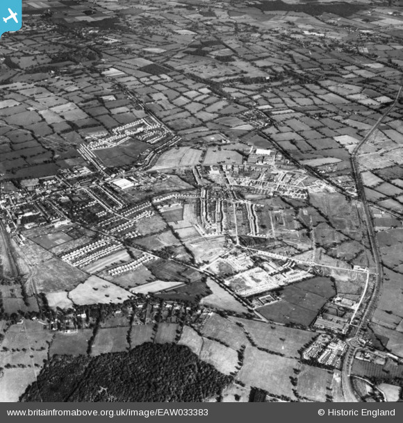
EAW033383 ENGLAND (1950). The area between Elstree Way, Furzehill Road and the Barnet Bypass under development, Borehamwood, 1950. This image has been produced from a print.
© Copyright OpenStreetMap contributors and licensed by the OpenStreetMap Foundation. 2026. Cartography is licensed as CC BY-SA.
Nearby Images (4)
EAW033383

EAW033381

EAW033382

EAW044273

Details
| Title | [EAW033383] The area between Elstree Way, Furzehill Road and the Barnet Bypass under development, Borehamwood, 1950. This image has been produced from a print. |
| Reference | EAW033383 |
| Date | 10-October-1950 |
| Link | |
| Place name | BOREHAMWOOD |
| Parish | ELSTREE AND BOREHAMWOOD |
| District | |
| Country | ENGLAND |
| Easting / Northing | 520217, 196541 |
| Longitude / Latitude | -0.26198117776935, 51.654320893144 |
| National Grid Reference | TQ202965 |
Pins

vc |
Friday 17th of January 2025 02:05:37 PM | |
|
vc |
Friday 17th of January 2025 02:05:08 PM | |
|
vc |
Friday 17th of January 2025 02:04:02 PM | |
|
a christie |
Thursday 6th of February 2020 08:53:51 PM | |
|
nkingdon |
Saturday 15th of October 2016 08:56:19 PM | |
|
John W |
Friday 29th of April 2016 09:41:42 PM |