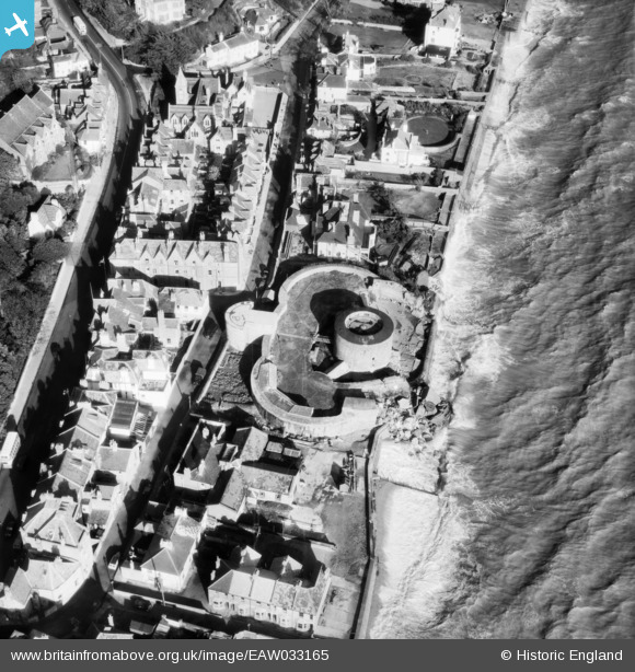
EAW033165 ENGLAND (1950). Sandgate Castle, Sandgate, 1950
© Copyright OpenStreetMap contributors and licensed by the OpenStreetMap Foundation. 2026. Cartography is licensed as CC BY-SA.
Nearby Images (10)
Details
| Title | [EAW033165] Sandgate Castle, Sandgate, 1950 |
| Reference | EAW033165 |
| Date | 5-October-1950 |
| Link | |
| Place name | SANDGATE |
| Parish | SANDGATE |
| District | |
| Country | ENGLAND |
| Easting / Northing | 620686, 135186 |
| Longitude / Latitude | 1.1506157530121, 51.072966862889 |
| National Grid Reference | TR207352 |
Pins

Sparky |
Wednesday 6th of September 2017 10:08:37 PM |


![[EAW033165] Sandgate Castle, Sandgate, 1950](http://britainfromabove.org.uk/sites/all/libraries/aerofilms-images/public/100x100/EAW/033/EAW033165.jpg)
![[EPW000649] Sandgate Castle, Sandgate, 1920](http://britainfromabove.org.uk/sites/all/libraries/aerofilms-images/public/100x100/EPW/000/EPW000649.jpg)
![[EAW033166] Sandgate Castle, Sandgate, 1950](http://britainfromabove.org.uk/sites/all/libraries/aerofilms-images/public/100x100/EAW/033/EAW033166.jpg)
![[EPW026115] Sandgate Castle and Sandgate High Street, Sandgate, 1929](http://britainfromabove.org.uk/sites/all/libraries/aerofilms-images/public/100x100/EPW/026/EPW026115.jpg)
![[EPW026119] Sandgate Castle and the village, Sandgate, 1929](http://britainfromabove.org.uk/sites/all/libraries/aerofilms-images/public/100x100/EPW/026/EPW026119.jpg)
![[EPW000146] Castle Road, Sandgate, 1920](http://britainfromabove.org.uk/sites/all/libraries/aerofilms-images/public/100x100/EPW/000/EPW000146.jpg)
![[EAW024823] The sea front including Sandgate Fort, Sandgate, 1949](http://britainfromabove.org.uk/sites/all/libraries/aerofilms-images/public/100x100/EAW/024/EAW024823.jpg)
![[EPW035415] Sandgate Castle, Radnor Cliff and the town of Folkestone, Sandgate, from the south-west, 1931](http://britainfromabove.org.uk/sites/all/libraries/aerofilms-images/public/100x100/EPW/035/EPW035415.jpg)
![[EAW024824] The sea front, Sandgate, from the south-west, 1949](http://britainfromabove.org.uk/sites/all/libraries/aerofilms-images/public/100x100/EAW/024/EAW024824.jpg)
![[EPW000145] Granville Parade, Sandgate, 1920](http://britainfromabove.org.uk/sites/all/libraries/aerofilms-images/public/100x100/EPW/000/EPW000145.jpg)