
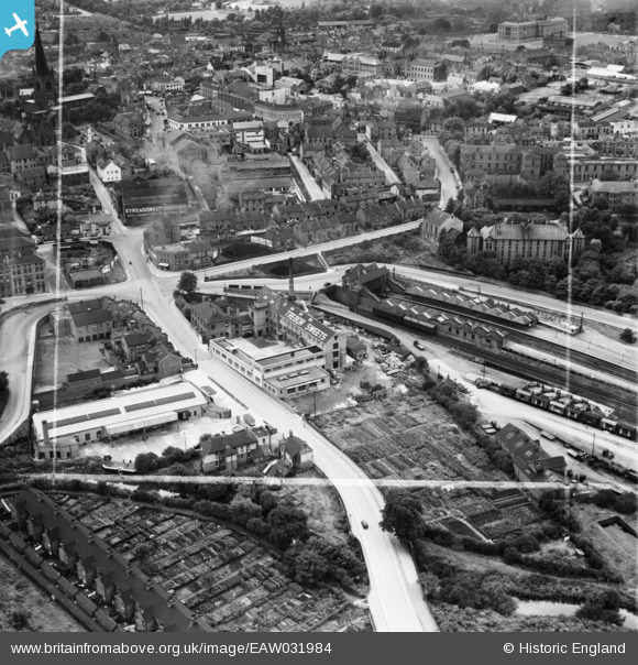
EAW031984 ENGLAND (1950). The Trebor Sweets Factory, Chesterfield Central Railway Station and environs, Chesterfield, 1950. This image was marked by Aerofilms Ltd for photo editing.
© Copyright OpenStreetMap contributors and licensed by the OpenStreetMap Foundation. 2026. Cartography is licensed as CC BY-SA.
Nearby Images (9)
EAW031984

EAW031981

EAW031982

EAW031985

EAW031983

EAW031978

EAW031980

EAW031979

EPW021081

Details
| Title | [EAW031984] The Trebor Sweets Factory, Chesterfield Central Railway Station and environs, Chesterfield, 1950. This image was marked by Aerofilms Ltd for photo editing. |
| Reference | EAW031984 |
| Date | 16-August-1950 |
| Link | |
| Place name | CHESTERFIELD |
| Parish | |
| District | |
| Country | ENGLAND |
| Easting / Northing | 438631, 371485 |
| Longitude / Latitude | -1.421110130364, 53.23870626286 |
| National Grid Reference | SK386715 |
Pins

dd1000 |
Wednesday 4th of January 2023 06:02:20 PM | |

DaveH |
Friday 9th of August 2019 06:34:12 PM | |
|
DaveH |
Friday 9th of August 2019 06:33:36 PM | |
|
RichardL |
Tuesday 5th of August 2014 12:12:25 PM |