
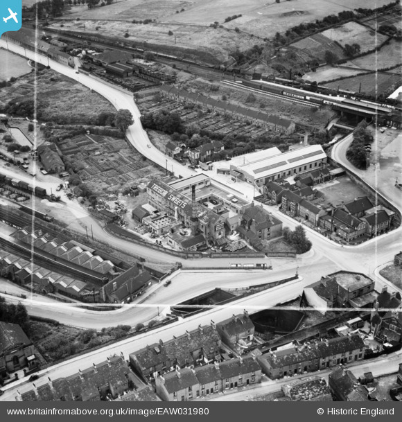
EAW031980 ENGLAND (1950). The Trebor Sweets Factory and environs, Chesterfield, 1950. This image was marked by Aerofilms Ltd for photo editing.
© Copyright OpenStreetMap contributors and licensed by the OpenStreetMap Foundation. 2026. Cartography is licensed as CC BY-SA.
Nearby Images (9)
EAW031980

EAW031985

EAW031983

EAW031979

EAW031981

EAW031982

EAW031984

EAW031978

EPW021081

Details
| Title | [EAW031980] The Trebor Sweets Factory and environs, Chesterfield, 1950. This image was marked by Aerofilms Ltd for photo editing. |
| Reference | EAW031980 |
| Date | 16-August-1950 |
| Link | |
| Place name | CHESTERFIELD |
| Parish | |
| District | |
| Country | ENGLAND |
| Easting / Northing | 438660, 371465 |
| Longitude / Latitude | -1.4206780140635, 53.238524363945 |
| National Grid Reference | SK387715 |
Pins

John W |
Tuesday 20th of December 2016 03:13:20 PM | |
|
John W |
Tuesday 20th of December 2016 03:12:27 PM |