
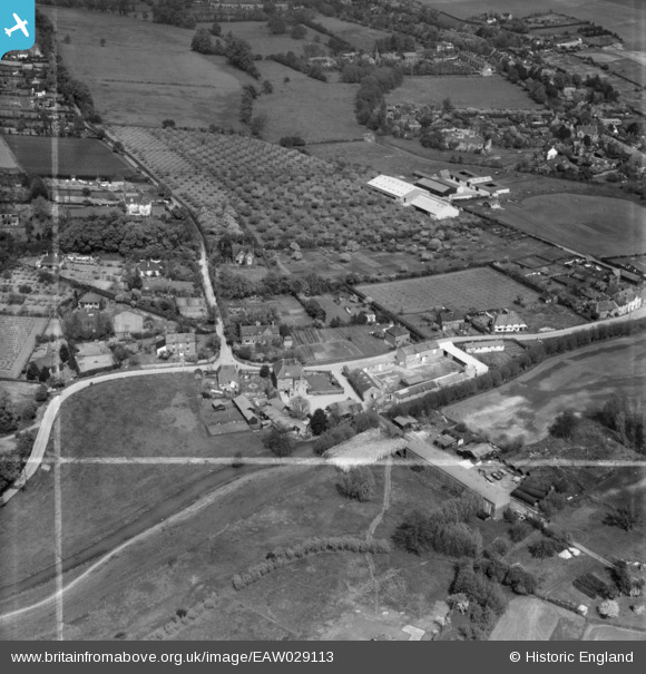
EAW029113 ENGLAND (1950). Home Farm and environs, Eynsford, 1950. This image was marked by Aerofilms Ltd for photo editing.
© Copyright OpenStreetMap contributors and licensed by the OpenStreetMap Foundation. 2026. Cartography is licensed as CC BY-SA.
Nearby Images (20)
EAW029113

EAW029125

EAW029126

EAW029120

EAW029118

EAW029123

EAW029119

EAW029124

EAW029121

EAW029122

EAW029117

EAW023111

EAW029110

EAW034953

EAW029115

EAW029109

EAW029114

EAW034956

EAW029111

EAW029116

Details
| Title | [EAW029113] Home Farm and environs, Eynsford, 1950. This image was marked by Aerofilms Ltd for photo editing. |
| Reference | EAW029113 |
| Date | 9-May-1950 |
| Link | |
| Place name | EYNSFORD |
| Parish | EYNSFORD |
| District | |
| Country | ENGLAND |
| Easting / Northing | 553805, 165665 |
| Longitude / Latitude | 0.20979260737116, 51.368689987799 |
| National Grid Reference | TQ538657 |
Pins
Be the first to add a comment to this image!