
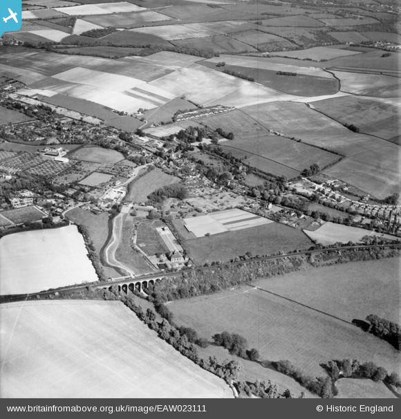
EAW023111 ENGLAND (1949). The Lullingstone Lane railway viaduct and the village, Eynsford, 1949
© Copyright OpenStreetMap contributors and licensed by the OpenStreetMap Foundation. 2026. Cartography is licensed as CC BY-SA.
Nearby Images (11)
EAW023111

EAW029122

EAW029124

EAW029121

EAW029120

EAW029118

EAW029125

EAW029119

EAW029113

EAW034953

EAW034956

Details
| Title | [EAW023111] The Lullingstone Lane railway viaduct and the village, Eynsford, 1949 |
| Reference | EAW023111 |
| Date | 10-May-1949 |
| Link | |
| Place name | EYNSFORD |
| Parish | EYNSFORD |
| District | |
| Country | ENGLAND |
| Easting / Northing | 553789, 165444 |
| Longitude / Latitude | 0.20946729030301, 51.366708411582 |
| National Grid Reference | TQ538654 |
