
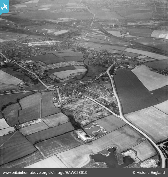
EAW028619 ENGLAND (1950). Eckington Road, West Street and the surrounding area, Beighton, 1950
© Copyright OpenStreetMap contributors and licensed by the OpenStreetMap Foundation. 2026. Cartography is licensed as CC BY-SA.
Nearby Images (4)
EAW028619

EAW028623

EAW028622

EAW028624

Details
| Title | [EAW028619] Eckington Road, West Street and the surrounding area, Beighton, 1950 |
| Reference | EAW028619 |
| Date | 6-April-1950 |
| Link | |
| Place name | BEIGHTON |
| Parish | |
| District | |
| Country | ENGLAND |
| Easting / Northing | 444045, 383055 |
| Longitude / Latitude | -1.3383813194048, 53.342289519509 |
| National Grid Reference | SK440831 |
Pins

Gasometerman |
Saturday 7th of November 2020 05:58:57 PM | |
|
RichardL |
Thursday 7th of August 2014 08:09:07 AM | |
|
RichardL |
Thursday 7th of August 2014 08:06:48 AM | |
|
RichardL |
Thursday 7th of August 2014 07:57:51 AM | |
|
RichardL |
Thursday 7th of August 2014 07:57:05 AM | |
|
RichardL |
Thursday 7th of August 2014 07:56:15 AM | |
|
RichardL |
Thursday 7th of August 2014 07:53:02 AM | |
|
RichardL |
Thursday 7th of August 2014 07:51:33 AM | |
|
RichardL |
Thursday 7th of August 2014 07:39:50 AM | |
|
RichardL |
Thursday 7th of August 2014 07:37:42 AM | |
|
RichardL |
Thursday 7th of August 2014 07:36:42 AM | |
|
RichardL |
Thursday 7th of August 2014 07:32:13 AM |