
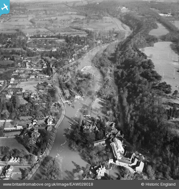
EAW028018 ENGLAND (1950). Boulter's Lock and the River Thames, Maidenhead, 1950
© Copyright OpenStreetMap contributors and licensed by the OpenStreetMap Foundation. 2026. Cartography is licensed as CC BY-SA.
Nearby Images (6)
EAW028018

EAW028017

EAW028019

EPW056585

EPW005696

EAW052776

Details
| Title | [EAW028018] Boulter's Lock and the River Thames, Maidenhead, 1950 |
| Reference | EAW028018 |
| Date | 17-February-1950 |
| Link | |
| Place name | MAIDENHEAD |
| Parish | |
| District | |
| Country | ENGLAND |
| Easting / Northing | 490360, 182429 |
| Longitude / Latitude | -0.69712894540177, 51.533047658831 |
| National Grid Reference | SU904824 |
Pins
Be the first to add a comment to this image!