
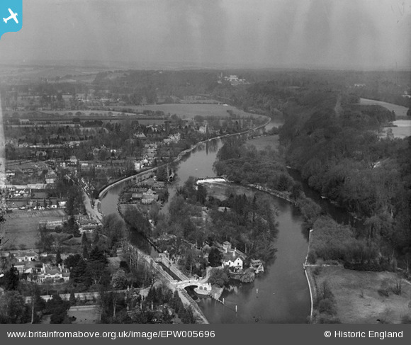
EPW005696 ENGLAND (1921). View over Maidenhead Court from Boulter's Lock and Ray Mill Island, Maidenhead, from the south, 1921
© Copyright OpenStreetMap contributors and licensed by the OpenStreetMap Foundation. 2026. Cartography is licensed as CC BY-SA.
Nearby Images (8)
EPW005696

EPW056585

EPW022723

EAW051193

EAW028018

EAW028019

EAW028017

EAW045408

Details
| Title | [EPW005696] View over Maidenhead Court from Boulter's Lock and Ray Mill Island, Maidenhead, from the south, 1921 |
| Reference | EPW005696 |
| Date | March-1921 |
| Link | |
| Place name | MAIDENHEAD |
| Parish | |
| District | |
| Country | ENGLAND |
| Easting / Northing | 490349, 182581 |
| Longitude / Latitude | -0.69724849363326, 51.534415919256 |
| National Grid Reference | SU903826 |
Pins

misterjohn |
Sunday 1st of January 2023 04:39:43 PM | |
|
misterjohn |
Sunday 1st of January 2023 04:38:03 PM |