
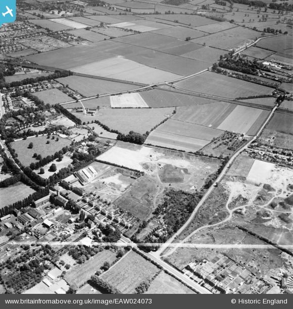
EAW024073 ENGLAND (1949). Old sand pits at Barkby Thorpe Lane, Thurmaston, 1949. This image was marked by Aerofilms Ltd for photo editing.
© Copyright OpenStreetMap contributors and licensed by the OpenStreetMap Foundation. 2026. Cartography is licensed as CC BY-SA.
Nearby Images (10)
EAW024073

EAW024074

EAW024075

EAW024077

EAW024067

EAW024069

EAW024068

EAW024070

EAW024072

EAW024071

Details
| Title | [EAW024073] Old sand pits at Barkby Thorpe Lane, Thurmaston, 1949. This image was marked by Aerofilms Ltd for photo editing. |
| Reference | EAW024073 |
| Date | 21-June-1949 |
| Link | |
| Place name | THURMASTON |
| Parish | THURMASTON |
| District | |
| Country | ENGLAND |
| Easting / Northing | 461700, 310248 |
| Longitude / Latitude | -1.0871279397165, 52.686059814683 |
| National Grid Reference | SK617102 |
Pins

Matt Aldred edob.mattaldred.com |
Friday 21st of February 2025 01:18:22 AM |