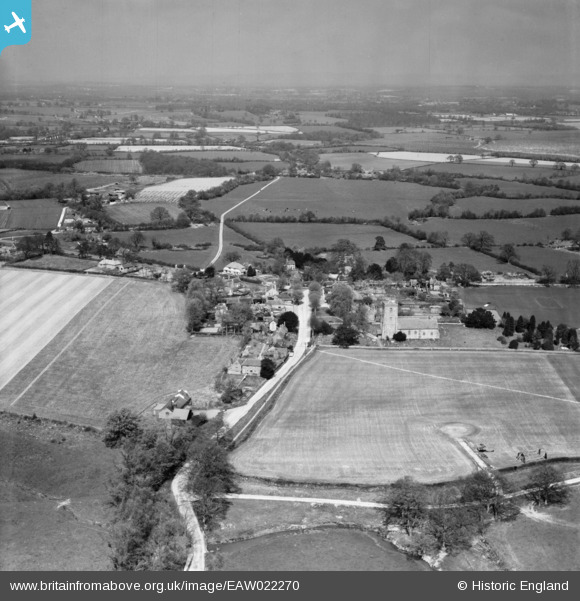
EAW022270 ENGLAND (1949). The village, Kirdford, from the south, 1949
© Copyright OpenStreetMap contributors and licensed by the OpenStreetMap Foundation. 2025. Cartography is licensed as CC BY-SA.
Details
| Title | [EAW022270] The village, Kirdford, from the south, 1949 |
| Reference | EAW022270 |
| Date | 18-April-1949 |
| Link | |
| Place name | KIRDFORD |
| Parish | KIRDFORD |
| District | |
| Country | ENGLAND |
| Easting / Northing | 501744, 126422 |
| Longitude / Latitude | -0.54899466614071, 51.027611571498 |
| National Grid Reference | TQ017264 |


![[EAW022270] The village, Kirdford, from the south, 1949](http://britainfromabove.org.uk/sites/all/libraries/aerofilms-images/public/100x100/EAW/022/EAW022270.jpg)
![[EAW022271] The village, Kirdford, from the south-east, 1949](http://britainfromabove.org.uk/sites/all/libraries/aerofilms-images/public/100x100/EAW/022/EAW022271.jpg)
![[EAW022273] The village, Kirdford, from the south-west, 1949](http://britainfromabove.org.uk/sites/all/libraries/aerofilms-images/public/100x100/EAW/022/EAW022273.jpg)
![[EAW022272] St John the Baptist's Church, Kirdford, 1949](http://britainfromabove.org.uk/sites/all/libraries/aerofilms-images/public/100x100/EAW/022/EAW022272.jpg)
