
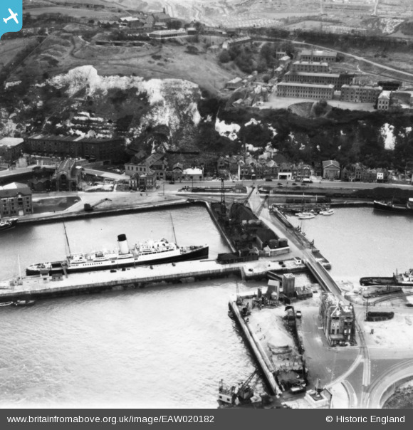
EAW020182 ENGLAND (1948). Union Street, Wellington Bridge and parts of the Western Docks, Dover, 1948. This image has been produced from a print.
© Copyright OpenStreetMap contributors and licensed by the OpenStreetMap Foundation. 2026. Cartography is licensed as CC BY-SA.
Nearby Images (20)
EAW020182

EAW020179

EAW020169

EAW020183

EAW020170

EAW020171

EAW020181

EPW000357

EAW020173

EAW020172

EAW020177

EAW020174

EAW020175

EAW020184

EAW020180

EAW007615

EAW020176

EAW020178

EPW019054

EPW000358

Details
| Title | [EAW020182] Union Street, Wellington Bridge and parts of the Western Docks, Dover, 1948. This image has been produced from a print. |
| Reference | EAW020182 |
| Date | 28-October-1948 |
| Link | |
| Place name | DOVER |
| Parish | DOVER |
| District | |
| Country | ENGLAND |
| Easting / Northing | 631695, 140780 |
| Longitude / Latitude | 1.3111003733788, 51.118852140323 |
| National Grid Reference | TR317408 |
