
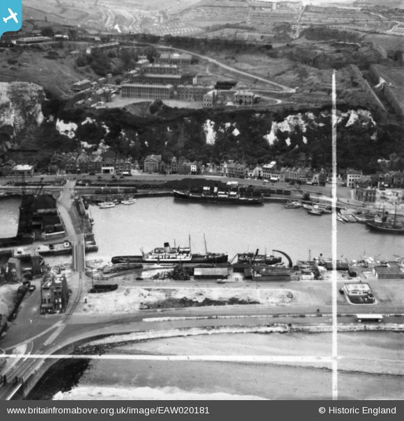
EAW020181 ENGLAND (1948). Wellington Dock and environs, Dover, 1948. This image has been produced from a print marked by Aerofilms Ltd for photo editing.
© Copyright OpenStreetMap contributors and licensed by the OpenStreetMap Foundation. 2026. Cartography is licensed as CC BY-SA.
Nearby Images (12)
EAW020181

EAW020170

EAW020179

EAW020173

EAW020183

EAW020182

EAW020180

EAW020169

EAW020184

EAW020174

EAW020171

EAW020172

Details
| Title | [EAW020181] Wellington Dock and environs, Dover, 1948. This image has been produced from a print marked by Aerofilms Ltd for photo editing. |
| Reference | EAW020181 |
| Date | 28-October-1948 |
| Link | |
| Place name | DOVER |
| Parish | DOVER |
| District | |
| Country | ENGLAND |
| Easting / Northing | 631745, 140907 |
| Longitude / Latitude | 1.3118952456944, 51.119972134384 |
| National Grid Reference | TR317409 |
Pins
Be the first to add a comment to this image!