
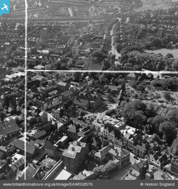
EAW018576 ENGLAND (1948). The High Street and Maidstone Road, Rochester, 1948. This image has been produced from a print marked by Aerofilms Ltd for photo editing.
© Copyright OpenStreetMap contributors and licensed by the OpenStreetMap Foundation. 2026. Cartography is licensed as CC BY-SA.
Nearby Images (13)
EAW018576

EAW018574

EAW018572

EAW018577

EAW018578

EAW018575

EAW018573

EAW003542

EAW018579

EPW062151

EAW004796

EAW004793

EAW003540

Details
| Title | [EAW018576] The High Street and Maidstone Road, Rochester, 1948. This image has been produced from a print marked by Aerofilms Ltd for photo editing. |
| Reference | EAW018576 |
| Date | 9-September-1948 |
| Link | |
| Place name | ROCHESTER |
| Parish | |
| District | |
| Country | ENGLAND |
| Easting / Northing | 574403, 168316 |
| Longitude / Latitude | 0.50674952497592, 51.386554594148 |
| National Grid Reference | TQ744683 |
Pins
User Comment Contributions
Sir Joseph Williamson's Mathematical School |

JohnC |
Thursday 15th of October 2015 03:22:47 PM |