
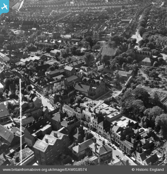
EAW018574 ENGLAND (1948). The High Street and Maidstone Road, Rochester, 1948. This image has been produced from a print marked by Aerofilms Ltd for photo editing.
© Copyright OpenStreetMap contributors and licensed by the OpenStreetMap Foundation. 2026. Cartography is licensed as CC BY-SA.
Nearby Images (13)
EAW018574

EAW018576

EAW018578

EAW018572

EAW018577

EAW018575

EAW018573

EAW003542

EAW018579

EAW004796

EPW062151

EAW004793

EAW003540

Details
| Title | [EAW018574] The High Street and Maidstone Road, Rochester, 1948. This image has been produced from a print marked by Aerofilms Ltd for photo editing. |
| Reference | EAW018574 |
| Date | 9-September-1948 |
| Link | |
| Place name | ROCHESTER |
| Parish | |
| District | |
| Country | ENGLAND |
| Easting / Northing | 574414, 168335 |
| Longitude / Latitude | 0.50691680183093, 51.38672191072 |
| National Grid Reference | TQ744683 |
Pins

alastair wallace |
Saturday 21st of November 2015 01:06:02 AM | |
|
medway |
Wednesday 19th of November 2014 11:25:50 PM |