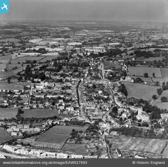
EAW017993 ENGLAND (1948). The town, Wooton-under-Edge, from the east, 1948. This image has been produced from a print.
© Copyright OpenStreetMap contributors and licensed by the OpenStreetMap Foundation. 2025. Cartography is licensed as CC BY-SA.
Nearby Images (7)
Details
| Title | [EAW017993] The town, Wooton-under-Edge, from the east, 1948. This image has been produced from a print. |
| Reference | EAW017993 |
| Date | 10-August-1948 |
| Link | |
| Place name | WOTTON-UNDER-EDGE |
| Parish | WOTTON-UNDER-EDGE |
| District | |
| Country | ENGLAND |
| Easting / Northing | 375856, 193261 |
| Longitude / Latitude | -2.3489147031033, 51.637168694633 |
| National Grid Reference | ST759933 |
Pins

Cokie |
Wednesday 22nd of February 2017 11:38:19 AM |


![[EAW017993] The town, Wooton-under-Edge, from the east, 1948. This image has been produced from a print.](http://britainfromabove.org.uk/sites/all/libraries/aerofilms-images/public/100x100/EAW/017/EAW017993.jpg)
![[EAW017994] The town, Wooton-under-Edge, from the east, 1948. This image has been produced from a print.](http://britainfromabove.org.uk/sites/all/libraries/aerofilms-images/public/100x100/EAW/017/EAW017994.jpg)
![[EPW023870] Long Street and the town, Wotton-under-Edge, 1928](http://britainfromabove.org.uk/sites/all/libraries/aerofilms-images/public/100x100/EPW/023/EPW023870.jpg)
![[EPW023866] The war memorial and environs, Wotton-under-Edge, 1928](http://britainfromabove.org.uk/sites/all/libraries/aerofilms-images/public/100x100/EPW/023/EPW023866.jpg)
![[EPW023865] St Mary's Church and the town, Wotton-under-Edge, 1928](http://britainfromabove.org.uk/sites/all/libraries/aerofilms-images/public/100x100/EPW/023/EPW023865.jpg)
![[EPW023867] St Mary's Church, Wotton-under-Edge, 1928](http://britainfromabove.org.uk/sites/all/libraries/aerofilms-images/public/100x100/EPW/023/EPW023867.jpg)
![[EPW023869] Long Street and the town, Wotton-under-Edge, 1928](http://britainfromabove.org.uk/sites/all/libraries/aerofilms-images/public/100x100/EPW/023/EPW023869.jpg)