
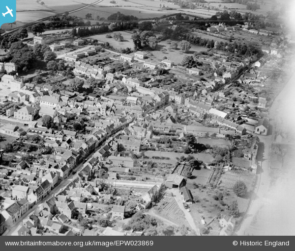
EPW023869 ENGLAND (1928). Long Street and the town, Wotton-under-Edge, 1928
© Copyright OpenStreetMap contributors and licensed by the OpenStreetMap Foundation. 2025. Cartography is licensed as CC BY-SA.
Nearby Images (5)
EPW023869

EPW023870

EPW023868

EAW017993

EPW023866

Details
| Title | [EPW023869] Long Street and the town, Wotton-under-Edge, 1928 |
| Reference | EPW023869 |
| Date | September-1928 |
| Link | |
| Place name | WOTTON-UNDER-EDGE |
| Parish | WOTTON-UNDER-EDGE |
| District | |
| Country | ENGLAND |
| Easting / Northing | 375632, 193302 |
| Longitude / Latitude | -2.3521546075159, 51.637527709253 |
| National Grid Reference | ST756933 |
Pins

sp |
Saturday 29th of February 2020 08:55:00 AM | |

Class31 |
Sunday 21st of October 2012 11:09:14 PM | |
|
Class31 |
Tuesday 16th of October 2012 10:45:24 PM | |
|
Class31 |
Tuesday 16th of October 2012 10:45:24 PM | |
|
Class31 |
Tuesday 16th of October 2012 10:45:01 PM | |
|
Class31 |
Tuesday 16th of October 2012 10:44:26 PM | |
|
Class31 |
Tuesday 16th of October 2012 10:44:11 PM | |
|
Class31 |
Tuesday 16th of October 2012 10:43:20 PM |