
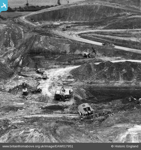
EAW017951 ENGLAND (1948). Opencast coal mining to the south of Kidsleypark Farm, Smalley, 1948. This image has been produced from a print.
© Copyright OpenStreetMap contributors and licensed by the OpenStreetMap Foundation. 2026. Cartography is licensed as CC BY-SA.
Nearby Images (48)
EAW017951

EAW017950

EAW017949

EAW018414

EAW018399

EAW018397

EAW018398

EAW018410

EAW011244

EAW018409

EAW012057

EAW012051

EAW025922

EAW011895

EAW011893

EAW011892

EAW011891

EAW011894

EAW011890

EAW011896

EAW012055

EAW011889

EAW012047

EAW025927

EAW011900

EAW011899

EAW017960

EAW012048

EAW012044

EAW011897

EAW011898

EAW025914

EAW025926

EAW018400

EAW025916

EAW017964

EAW025918

EAW025921

EAW011252

EAW033476

EAW012041

EAW012042

EAW011251

EAW018404

EAW012040

EAW012039

EAW018403

EAW018405

Details
| Title | [EAW017951] Opencast coal mining to the south of Kidsleypark Farm, Smalley, 1948. This image has been produced from a print. |
| Reference | EAW017951 |
| Date | 10-August-1948 |
| Link | |
| Place name | SMALLEY |
| Parish | SMALLEY |
| District | |
| Country | ENGLAND |
| Easting / Northing | 441483, 345741 |
| Longitude / Latitude | -1.3817052509535, 53.007065263968 |
| National Grid Reference | SK415457 |
Pins

Billy Turner |
Thursday 9th of March 2017 09:36:54 PM | |
|
Billy Turner |
Thursday 9th of March 2017 09:28:48 PM |

